ACCURATE MEASUREMENT OF THE AREA
MULTI PURPOSE AGRONOMIST HELPER
Area measurement and field management

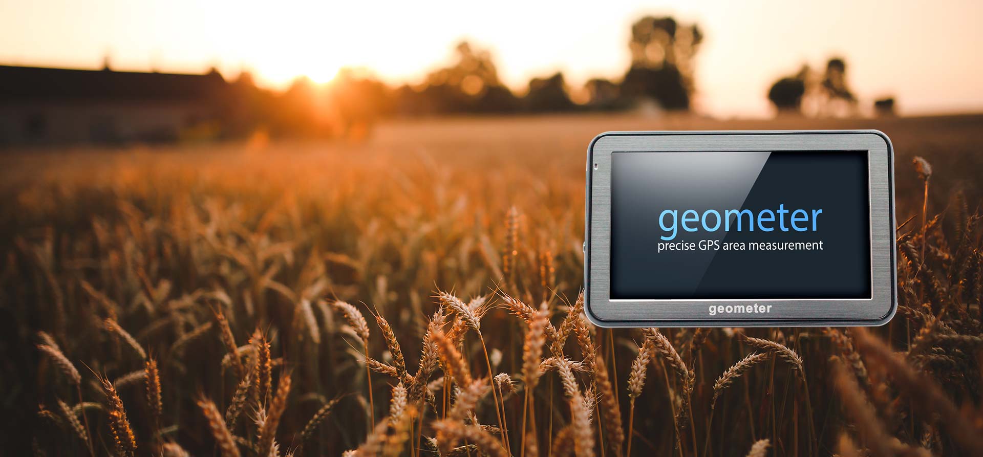
Geometer GPS
Accurate measurement of the fields’ area
Series S SLIM – the size of the fields’ meter of the Slim series is unique - the thickness of the devices is 11.95 mm, which is approximately 1.5 times less than that of competing models. With such an indicator, the speed of the device has no analogues among other products that the market offers.
The S Series GeoMeter has a wide touch screen for easy operation in the field. Work management and fields’ area measurements are performed by touching the screen. Built-in road maps will help you to find the right and short route to your desired destination.
Call us: +38-050-842-61-65
Comfortable work with the big screen. Friendly interface. Use GeoMeter to measure fields’ area easily, lightly and conveniently!
How it works
It is enough to bring GeoMeter with you and bypass or drive around the area of the field you want to measure. All measurements and calculations will be performed automatically after starting the command “Start Measuring”. The system automatically calculates the error rate. If obstacles are encountered on the road during measurements, you can easily stop recording points using the “Pause” button. After passing the obstacle, continue to record the contour points of the field. If your field is divided into several sections, and this should be taken into account when calculating, you can mark them in different colors and measure each individually. You will also be able to see the total area.
During measurements, the shape of the measured area will be formed on the screen. In the process of measurement, it will be displayed its area, perimeter and length of the traversed path. At the end of the work, you can specify the name of the area that was measured, and save it in the device memory. Data from the device is easily transferred to the computer using a flash card or cable.


Your fields on the map
The Agroprofile system was designed to increase the efficiency of using GPS devices, as well as to display and store files from GeoMeter, GeoTrack devices, as well as online monitoring sensors. Display your fields on the map, plan your work with colleagues and get accurate reports on using all of the resources involved.
Use free online crop yield planning system to improve your business performance. The Agroprofile system will save you money, provide you with modern tools and allow you to control your work processes better.
Increase accuracy
GeoMeter S5 have a built-in Bluetooth module, with which you can connect an external GNSS satellite receiver of any class of accuracy. You can connect GNSS receivers of any manufacturer. GeoMeter company offers its own solutions for improving positioning accuracy: from decimeter accuracy (GM PRO) to centimeter accuracy (GM PRO RTK). The device GeoMeter with RTK receiver becomes a professional device that can perform any tasks not only in agriculture, but also in geodesy, forestry, construction, road construction, utilities, and other land research.
RTK technology is a technique that allows you to get corrections to measurements and set the location with centimeter accuracy in real time. Depending on the task and operating conditions, the necessary set is selected for operation with RTK accuracy. These can be cost-effective solutions using single-frequency RTK L1 receivers, or traditional kits with dual-frequency RTK L1/L2 receivers, as well as selection according to the type of receiving/transmitting corrections: radio or Internet.

Maximum possibilities with the Agroprofile system

Dividing of fields
Need to measure the area and divide the field in half? There is nothing simpler! You can do it, just touching the right place on the screen. And the plot will be divided according to your parameters. You define how to divide the field.
More convenient field dividing function: you personally select 2 points on the measured area, with which you divide the field and the function of determining the waterlogged, etc. non-productive zones from the total area of the fields, will allow you to find out what is the total area and the area of only productive land.
Multi purpose helper
Fields’ area measurements can be performed on foot or by car, in any weather and season. Any information you can get right in the field. The device is capable for operating anywhere in the world where the GPS signal is available.
With the help of GeoMeter device, an agronomist, accountant or farm manager can quickly and accurately measure the area of the fields, set the required points on the ground and return to them at any time. All data is easily transferred to a PC using a USB cable.
Realtime measurements
The device for measuring area GeoMeter works in real time. During the movement a figure of the measured area is formed on the screen.
Accuracy for any tasks
Use professional GNSS receivers to connect to GeoMeter devices and get centimeter accuracy.
Frequently Asked Questions
How does the system determine my location and where does it work?
The system is positioned using the information received from GPS satellites or GLONASS. It works around the world, because satellite positioning systems cover the entire planet.
Which precision improvement technologies are used in GeoMeter devices?
GeoMeter devices use free corrections from European stations EGNOS. The software was specifically designed to improve the accuracy of area measurement, software filters and algorithms that improve the accuracy of the determination of coordinates. Also, a static mode of measurement is provided, which gives the highest possible accuracy.
After measuring the area it is necessary to divide the area into two parts and find out the area of these particles. It's possible?
GPS GeoMeter devices have several ways to divide the area. Each way divides the area into parts and immediately shows the area of the divided sections.
Is there a subscription fee for using satellite systems?
The use of satellite systems is absolutely free. You only pay the cost of the GeoMeter device and use it on a permanent basis without additional contributions.
Is it possible to measure the area of uneven shape?
With the help of GPS GeoMeter device you can measure the area of any form. When passing along the boundary of the measured area, the system will record the point with the set period (for example, 1 meter). Any figure you will bypass will be saved and measured.
How to see the measured fields on a personal computer? How to store the database of all fields?
With the help of agroprofile.com system, you can save all your fields, see them over Google Maps, see weather online for each field, maintain a history of field processing, plan your current work, get reports, print out any information and so on. Agroprofile is free of charge farm management system.
What is the accuracy of measuring the area using the GeoMeter device?
The accuracy of measurement area is not worse than 0.5% when measuring fields from 1 hectare. It is also possible to improve accuracy with the help of external GNSS receivers.
Can I measure the total area of plots that are unrelated to each other?
Sure! GeoMeter devices support the function of measuring the area by segments.
I am in Australia, will the device work here?
GeoMeter device will work not only in Australia, but also anywhere in the world, where there is a satellite signal. You just have to turn on the device in the open area and GeoMeter will detect a sufficient number of satellites to work.